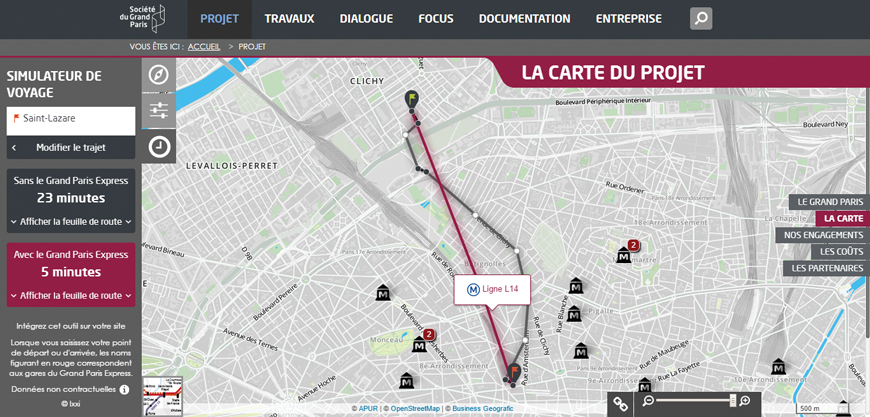
The French Société du Grand Paris' mapping application is based on the GEO Technologies. Discover the current and future public transport network in Paris, the touristic spots within Paris and the Grand Paris Express project planning. The route planning calculator will show you how much time you can save when travelling from, to and within Paris.
This mapping application for the general public is evolving constantly. It will soon propose 3D visualization, among other enrichments.