


GEO Decisions
SPATIAL INTELLIGENCE FOR ALL
Business Geografic integrates the geographical dimension at the heart of the decision-making processes, with an ongoing dynamic combining creativity and technological progress.
Géoclip enables you to draw the portrait of your territory by creating geostatistical observatories in web mode. Géoclip meets all geostatistical observation and communication needs.
GEO Key is a universal Geo-Business Intelligence solution, designed to build powerful decision-making and prospective cartographic dashboards that are dynamically linked to the data, regardless of the nature and volumes of the data.
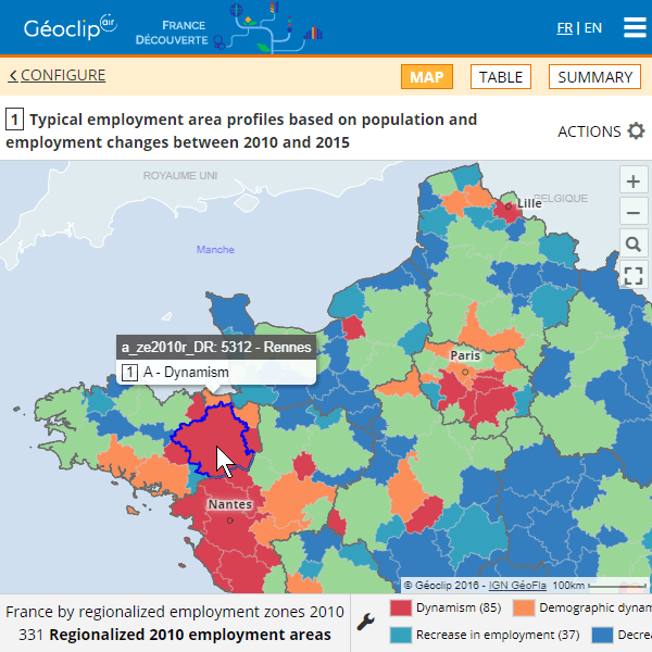
Géoclip
Draw the portrait of your territory through a geostatistical observatory in web mode. Observatories based on Géoclip are benchmarked for their semiological relevance and quality of reporting.
Géoclip is a statistical web mapping solution for all geostatistical observation and communication needs of public and private structures. Géoclip promotes shared knowledge of territories.
équitée
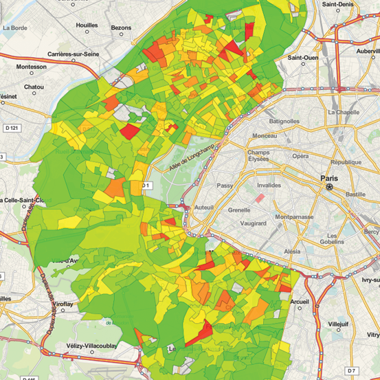
Set and launch automated territorial diagnoses. Equitée is a geo-analytics tool aimed at drawing territorial strategies by aggregating, filtering and synthesizing very big volumes of data and indicators.
Model, test and manage your land programs. Equitée is a powerful tool for your strategic land development planning. Equitée helps you make the transition towards an efficient Climate and Energy land strategy.
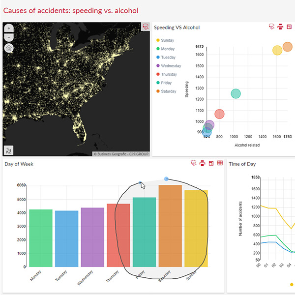
GEO Key
Generate in record time your own responsive HTML5 carto-centric dashboards to analyze your spatial, contextual and business data and indicators.
GEO Key is the universal and innovative solution for all Geo-Business Intelligence needs, from Geo-Reporting and Observatories to Geo-Prospective by way of Geo-Analytics.


