


GEO Software
GIS innovation
Published on 27 October 2015
Innovation is in Business Geografic’s DNA. GEO, Business Geografic’s GIS and Location Intelligence platform, is acclaimed worldwide. GEO offers state-of-the-art technologies, tools and solutions to generate, disseminate and share all sorts of multi-public ...

GEO Software
GEO Technologies
Published on 27 October 2015
GEO TECHNOLOGIES : interoperability and power.

GEO Software
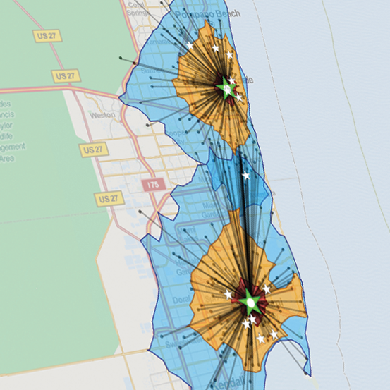
GEO Decisions
Published on 27 October 2015
GEO DECISIONS: spatial intelligence for all.
GEO Technologies
GEO Technologies
Published on 10 February 2016
INTEROPERABILITY AND POWER
Business Geografic is the acknowledged expert of autonomous GIS generation. Create and publish meaningful cartographic applications in responsive HTML5 mode, using all formats of standardized geographic and business data.
Business ...
GEO Technologies
GEO Generator
Published on 10 February 2016
Business Geografic's GEO Generator is a universal mapping engine that provides you with the highest levels of freedom and autonomy ever offered on the global GIS market.
Generate by yourself tailored maps and cartographic applications in responsive ...
GEO Technologies
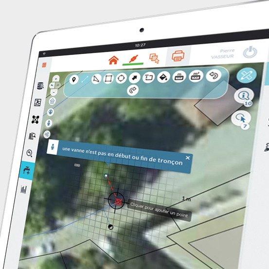
GEO for mobile
Published on 10 February 2016
GEO for mobile supports mobile GIS needs, by enabling you to use your GEO solutions and applications out in the field, without functional nor technical compromise, in both online and offline modes, with real-time or delayed data synchronization.
GEO ...
GEO Technologies
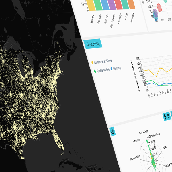
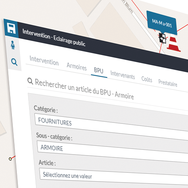
GEO Interventions
Published on 10 February 2016
GEO Interventions enriches your GEO applications and solutions with dedicated features and information sheets for the management and the supervision of intervention requests and field operations on all kinds of public assets: infrastructures, roadways, ...
GEO Technologies
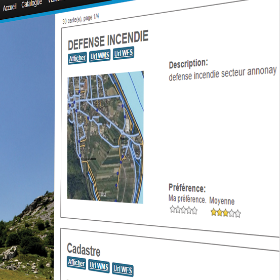
GEO SDI
Published on 10 February 2016
GEO SDI brings together all the necessary technologies and tools that you need to implement your Spatial Data Infrastructure (SDI).
Build your GIS platform in line with OGC’s standards and the ISO requirements laid down by the European INSPIRE ...
GEO Technologies
GEO Services
Published on 10 February 2016
Business Geografic's GEO Services are universal mapping services available in SaaS mode. They are compatible with any kind of standardized data format.
Enrich all your maps, cartographic applications and business tools with high value geospatial ...
GEO Solutions
GEO Solutions
Published on 10 February 2016
MODULARITY AND ACCURACY
Business Geografic provides a wide and modular range of GEO solutions for all kinds of public and private structures. All GEO solutions are interconnected within the GEO platform to ensure perfect technological consistency.
Your ...

GEO Solutions
Cadaster
Published on 10 February 2016
YOUR SHARED CADASTRAL DATA REPOSITORY.
Manage and publish by yourself your cadastral data while complying with data dissemination legal requirements. GEO Cadaster is the cadastral data repository shared among all technical departments within your ...

GEO Solutions
Land Zoning
Published on 10 February 2016
LAND ZONING CROSSED WITH YOUR CADASTRAL DATA.
Combine GEO Land Zoning together with GEO Cadaster to access, disseminate and process your data related to land zoning: districts maps, urban planning data and all kinds of land zones.
Enrich your ...

GEO Solutions
Urban Planning
Published on 10 February 2016
URBAN PLANNING FROM THE GIS ANGLE.
Locate, edit and analyze your urban planning records directly within their geographical context. GEOXALIS integrates the spatial dimension at the heart of your urban planning and land management processes.
GEOXALIS ...

GEO Solutions
Non-collective Sanitation
Published on 10 February 2016
NON-COLLECTIVE SANITATION UNDER GEO SUPERVISION.
Map, analyze and edit your non-collective sanitation facilities. GEO Non-Collective Sanitation enables you to oversee and supervise all your non-collective sanitation facilities.
Manage your ...

GEO Solutions
Collective Sanitation
Published on 10 February 2016
COLLECTIVE SANITATION UNDER GEO MANAGEMENT.
Map, analyze and edit your entire collective sanitation network. GEO Collective Sanitation provides you with a 360-degree view over your collective sanitation network and its surrounding environment. ...

GEO Solutions
Drinking Water
Published on 10 February 2016
WATER SUPPLY MANAGEMENT WITH GEO.
Manage your drinking water and runoff water pipeline networks with GEO: GEO Drinking Water offers enhanced features such as flow display, forebay search, valve management, fire hydrants, leak location, etc.
GEO ...

GEO Solutions
Electricity
Published on 25 February 2021
THE CONTROLLED MANAGEMENT OF ELECTRICITY NETWORKS.
Map, visualize and manage your networks and infrastructures dedicated to electricity production, transportation and distribution.
GEO Electricity is the GIS tool dedicated to the smart operations, ...

GEO Solutions
Telecoms
Published on 25 February 2021
THE MANAGEMENT OF TELECOM NETWORKS AND INFRASTRUCTURES.
Map, visualize and manage your telecom assets directly within their geospatial context.
NetGEO Telecom is the GIS tool dedicated to the smart deployment, operations and maintenance of telecom networks ...

GEO Solutions
Lighting
Published on 10 February 2016
LIGHTING UNDER ENERGY MONITORING.
Monitor and master your energy use all along your street lighting network. GEO Lighting enables you to map all of your electrical assets, for supervision and analytics purposes.
Make operating status diagnoses ...
GEO Technologies
GEO TECHNOLOGIES :
interoperability and power.
GEO Solutions
GEO SOLUTIONS :
modularity and accuracy.
GEO Decisions
GEO DECISIONS :
spatial intelligence for all.


