


GEO Technologies
Published on 10 February 2016
GEO SDI brings together all the necessary technologies and tools that you need to implement your Spatial Data Infrastructure (SDI).
Build your GIS platform in line with OGC’s standards and the ISO requirements laid down by the European INSPIRE...

GEO Solutions
Published on 10 February 2016
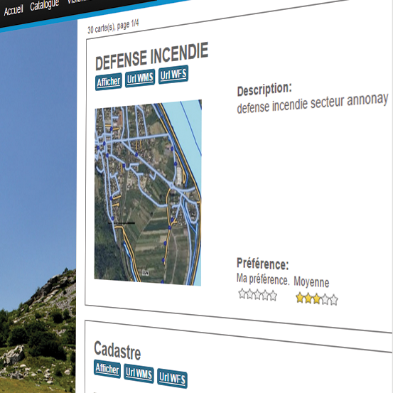
YOUR SHARED CADASTRAL DATA REPOSITORY.
Manage and publish by yourself your cadastral data while complying with data dissemination legal requirements. GEO Cadaster is the cadastral data repository shared among all technical departments within your...
GEO Decisions
Published on 10 February 2016
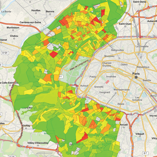
Set and launch automated territorial diagnoses. Equitée is a geo-analytics tool aimed at drawing territorial strategies by aggregating, filtering and synthesizing very big volumes of data and indicators.
Model, test and manage your land programs. Equitée...
GEO Technologies
Published on 10 February 2016
Business Geografic's GEO Services are universal mapping services available in SaaS mode. They are compatible with any kind of standardized data format.
Enrich all your maps, cartographic applications and business tools with high value geospatial...

GEO Technologies
Published on 10 February 2016
GEO for mobile supports mobile GIS needs, by enabling you to use your GEO solutions and applications out in the field, without functional nor technical compromise, in both online and offline modes, with real-time or delayed data synchronization.
GEO...
GEO Technologies
Published on 10 February 2016
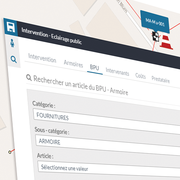
GEO Interventions enriches your GEO applications and solutions with dedicated features and information sheets for the management and the supervision of intervention requests and field operations on all kinds of public assets: infrastructures, roadways,...


